Collaborative virtual environments
3-D and 4-D geo-referenced GIS
Database backend
Multiple users at distributed locations
Hyperlinked multimedia displays
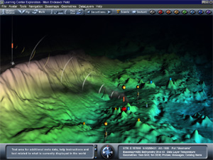
Learning Center Explorations immerse users in 4-D, GIS-based virtual worlds where participants can fly or walk over an experimental site, plan fieldwork, probe data sets and share messages. They can also view 360° computer generated panoramas, remotely collected imagery and animated time series data.
While connected, participants can collaborate from distributed locations, viewing the perspective of other participants through the click of a button. Additionally, participants can call up animations, graphs and 3D geometries of scientific data sets from the Learning Center Catalog and collaboratively discuss related issues.
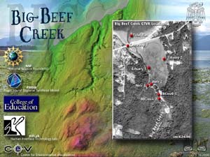
Spatial data sets from the Big Beef Creek, PRISM and NEPTUNE projects are being used to develop these collaborative 4D maps. They represent a prototype for on-line scientific exploration utilizing the Internet2 and the next generation of educational networks.

|