Copyright © Center for Environmental Visualization| ALL RIGHTS RESERVED.

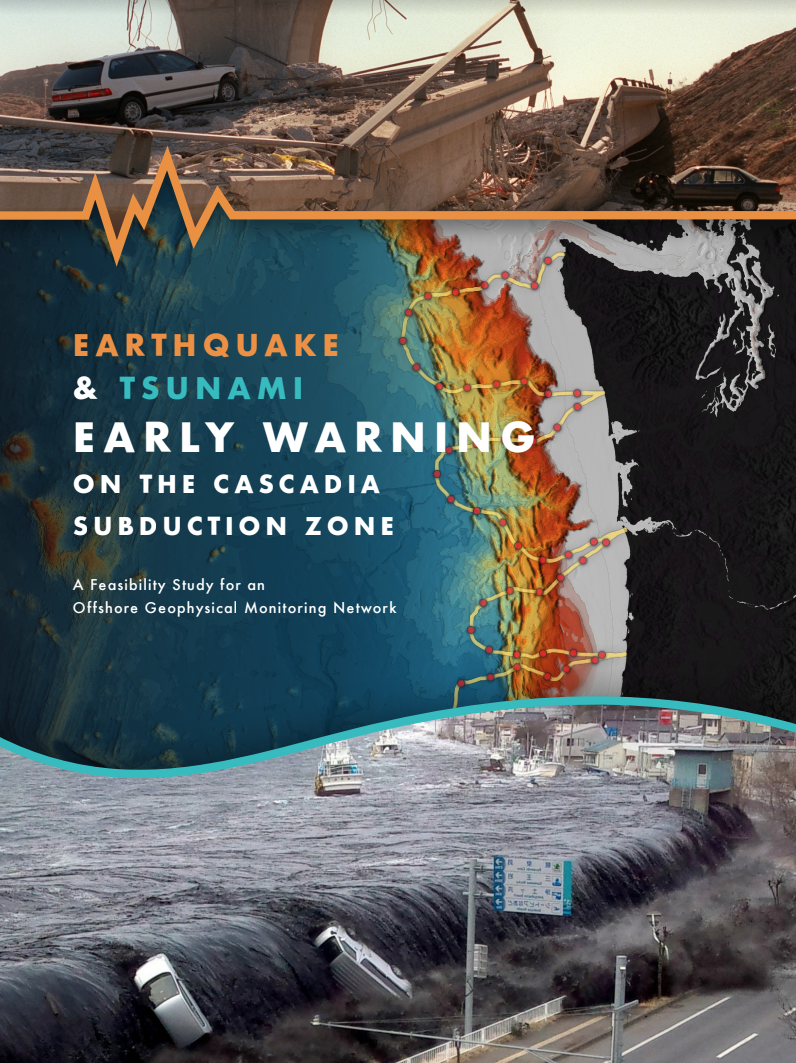
Represented here is the cover for the Earthquake & Tsunami Early Warning on the Cascadia Subduction Zone, A Feasibility Study for an Offshore Ge
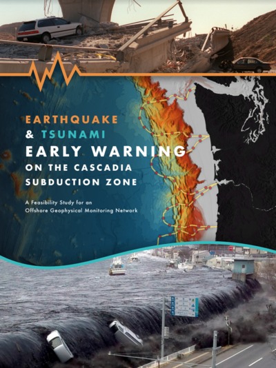
Represented here is the cover for the Earthquake & Tsunami Early Warning on the Cascadia Subduction Zone, A Feasibility Study for an Offshore Ge
×
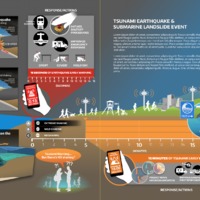
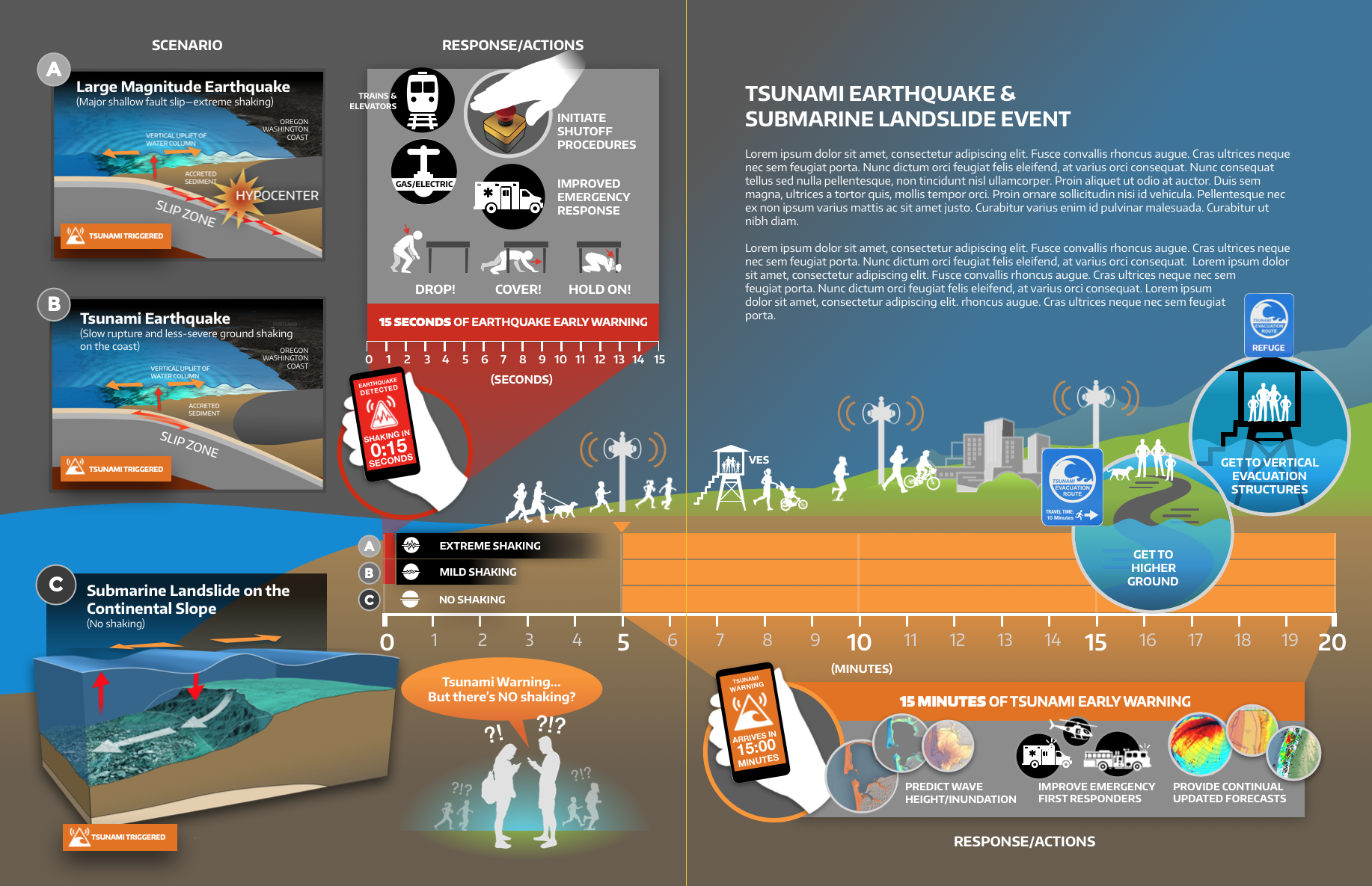
Here, displacement of material along the seafloor creates a large tsunami wave without any ground shaking felt at the coastline. These sce

Here, displacement of material along the seafloor creates a large tsunami wave without any ground shaking felt at the coastline. These sce
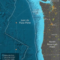
×This study advances efforts to implement earthquake early warning along the West Coast of the United States. An optimized detection and warning system must be adapted to the local geology and particular earthquake risks for a region. Compared to other plate boundaries, residents of subduction zone environments likely benefit the greatest from earthquake early warning because the population is likely to receive the longest warning times. This is because the major inland populations are far from the earthquake source, which lies almost entirely offshore. But subduction zones present a challenge: the geophysical network that detects the earthquake is limited to the land, rather than surrounding the earthquake source region offshore. Subduction zones also pose a second major hazard in the form of a tsunami that is frequently triggered by the offshore earthquake. Therefore, the timeliness, accuracy, and reliability of earthquake and tsunami early warning in subduction zones, such as found in the Pacific Northwest, would be enhanced by offshore geophysical instrumentation. However, offshore instrument networks are technically challenging to design, install, and maintain.
The feasibility and design of an offshore geophysical network for earthquake and tsunami early warning in the Pacific Northwest was evaluated by a team of scientists and engineers at the University of Washington with support from the Gordon and Betty Moore Foundation. The team’s goals were to (1) consider the justification for such a system, (2) identify the high-level system specifications, (3) evaluate current and emerging technologies, (4) determine the feasibility and approximate costs of illustrative designs, and (5) make recommendations about the path forward. To inform the study, a workshop of over 100 participants was organized with attendees drawn primarily from academia, but with representatives also present from federal agencies, industry, the emergency management community, and the media. The deliberations and recommendations of the workshop were important in guiding the completion of the study. This report and its supporting documents present the study’s results.
The instrument network designs presented here are neither final nor optimized, but rather are illustrative of options that utilize established and emergent approaches. While the report notes the necessity of incorporating an offshore geophysical network into a comprehensive strategy for preparedness, education, warning, and response, it does not present a holistic mitigation plan, nor does it explore in any detail how offshore data would be integrated with existing warning systems that are operated by the United States Geological Survey (USGS) and the National Oceanographic and Atmospheric Administration (NOAA). This report is best viewed as a resource on the scientific and technical considerations, as well as the societal benefit, for earthquake and tsunami detection in subduction zones, such as in Cascadia and similar locations across the planet with populations at risk.
Represented here is the cover for the Earthquake & Tsunami Early Warning on the Cascadia Subduction Zone, A Feasibility Study for an Offshore Ge
Represented here is the cover for the Earthquake & Tsunami Early Warning on the Cascadia Subduction Zone, A Feasibility Study for an Offshore Ge
×
Here, displacement of material along the seafloor creates a large tsunami wave without any ground shaking felt at the coastline. These sce
Here, displacement of material along the seafloor creates a large tsunami wave without any ground shaking felt at the coastline. These sce
×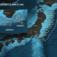
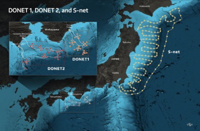
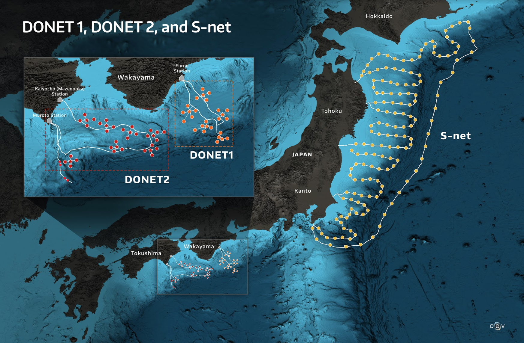
The DONET (Dense Oceanfloor Network System for Earthquakes and Tsunamis) observatory was developed by JAMSTEC (Japan Agency for Marine-Earth Sc Link
×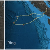
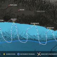
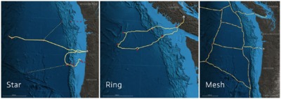
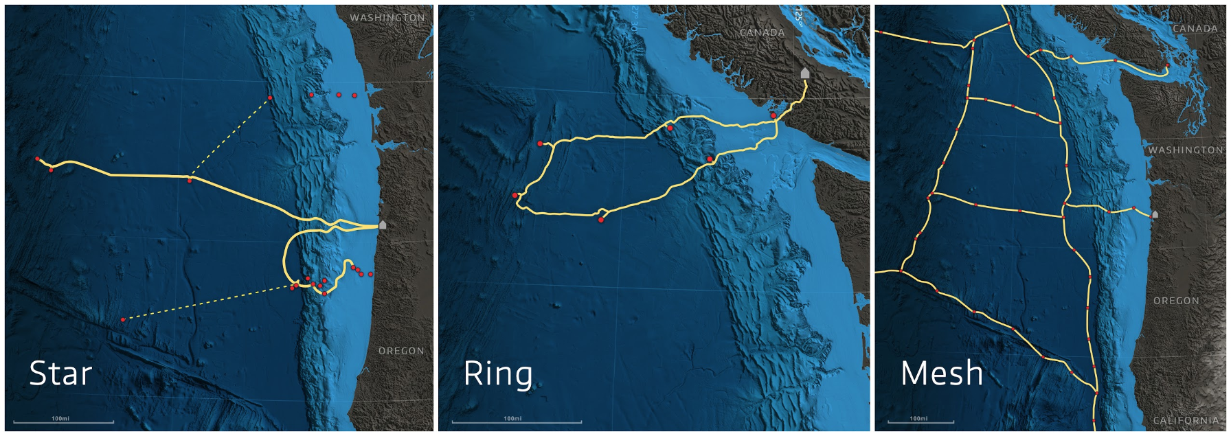
Installation costs for a representative hardwired and connectorized EEW/TEW system can be estimated by assuming the topology and number of sh Link
×

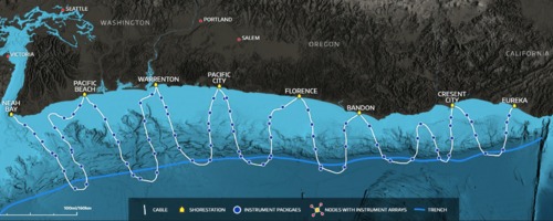
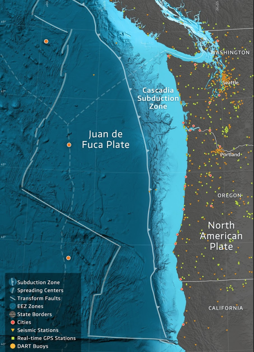
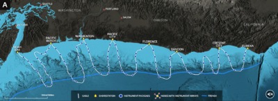
The Pacific Northwest with geological features, political boundaries, and existing onshore geophysical instrumentation labeled. Link
×
Represented here is the cover for the Earthquake & Tsunami Early Warning on the Cascadia Subduction Zone, A Feasibility Study for an Offshore Ge Link
×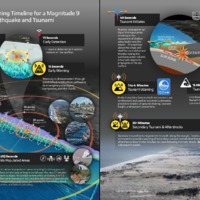
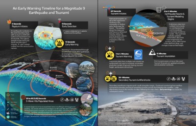
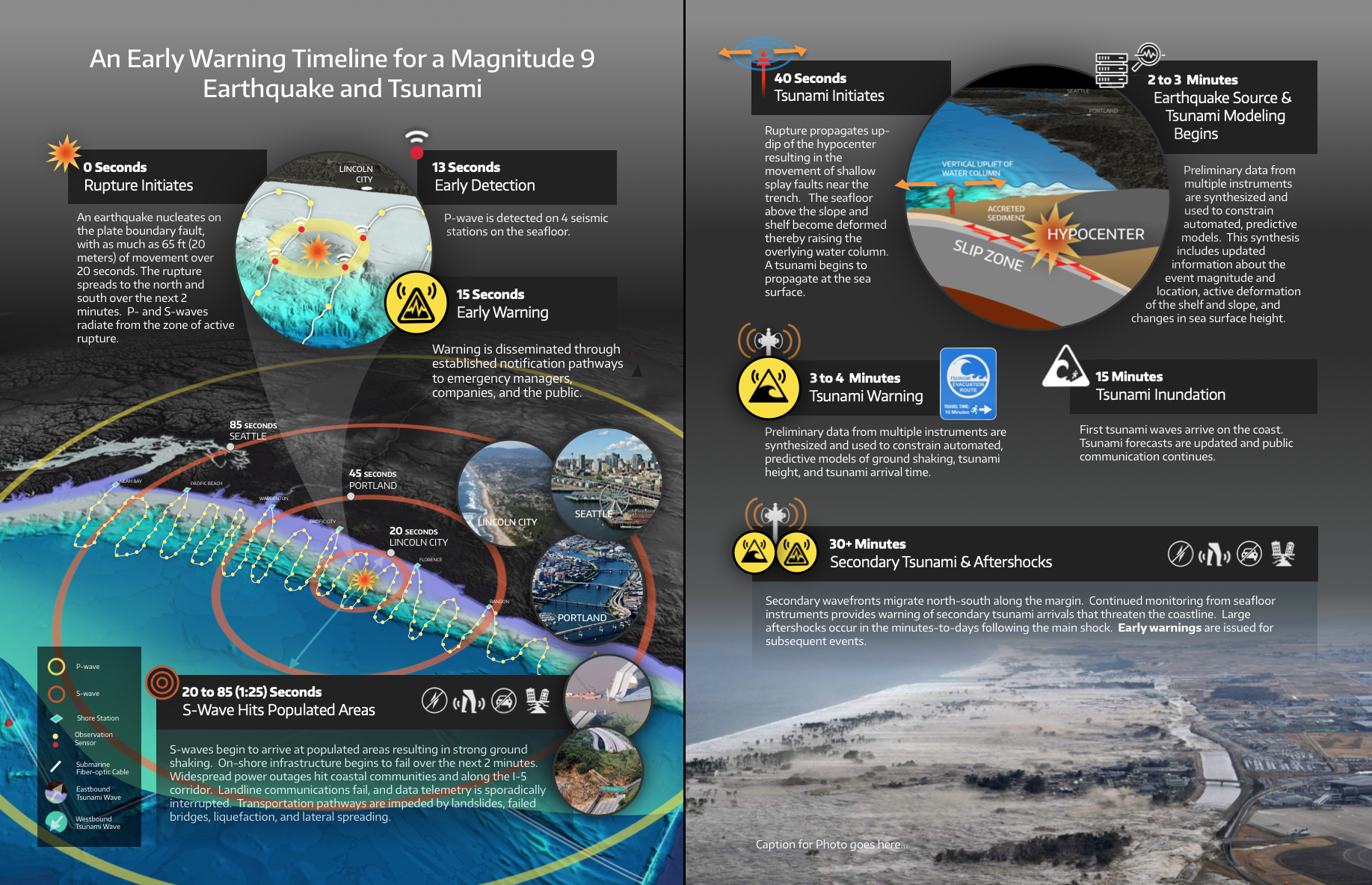
The scenario illustrated here uses a hypothetical source hypocenter (the initiation point of the earthquake rupture) approximately 40 miles off Link
×