
Big Beef Creek
GIS & Mapping
Integrated Data Distribution
MIXED (Model/measurement Integration Experiment in Estuary Dynamics)
Puget Sound Nearshore Ecosystem Restoration Program- Nearshore Science Team
Remote Sensing
Remote Sensing in Natural Hazards
Questions or
comments:
Miles Logsdon
Updated:
2003-02-13
|
 |
|
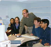
Welcome to the Spatial Analysis Lab in the College of Ocean and Fishery Sciences at the University of Washington. The lab is located in room 111 of the Ocean Science Building on the South Campus in Seattle.
|
- Introduction to Geographic Information Systems in Forest Resources (CFR250, Fall & Winter)
This course introduces the technical use of geographic information systems (GIS) in natural resource management and earth sciences. The course is directed at giving students an understanding of, and experience with, the practical use of GIS software, hardware, and data. Lab exercises and course projects will use real-world data sets.
- Spatial Information Technologies: Integrating GPS, GIS, and Remote Sensing for Earth Science (OCE452 / FSH453, 3 credits, Fall)
This course is designed to introduce the use of GPS, GIS and Remote Sensing Technologies in the fields of ecosystem sciences. In this course each student will participate in the collection of georeferenced field measurements and observations (GPS), importing those spatial data into a GIS, classifying the land and water surfaces over the spatial extent of those data from remotely sensed imagery, and analyzing their spatial variability. This course is intended to integrate these technologies in an applied setting, and to motivate students to incorporate these tools and techniques in their future work.
- SEMINAR: Spatial Analysis Lab (OCE506 / FSH507, 1-2 credits, Spring)
This seminar follows the current literature and applications of spatial information technologies, and engage students in exercises, discussions, and research design that prepares or assists them in conducting their own research using GIS and Remote Sensing. The course is intended to bring together students and faculty actively engaged in GIS & RS and serve as an opportunity for information exchange. This course is intended for advanced GIS and Remote Sensing students and those that are currently (or soon plan to) use these tools in their own research.
- Land and Water Remote Sensing in the Coastal Environment (OCE499 / FSH497, 3 credits, Winter)
This course offers an interdisciplinary approach to understanding the bases for the classification of Satellite Remote Sensing data, applications of that data in research, and the skill set necessary for the construction of geospatial dataset derived from multispectral remotely sensed data. The emphasis is on the varitey of sensors that are available and their application to Coastal Studies.
- Natural Hazards, Remote Sensing and Spatial Analysis (special topic course, unscheduled)
Our landscape and seascape are bothy dynamic and ever changing environments where human activities are often in conflict with natural processes. This is most important in our coastal settings. One of the most powerful tools in understanding these processes is found in the application of GIS and related technologies. By implementing an integrated approach to coastal zone mangement that takes advantage of GIS, remote sensing and related technologies, coastal hazard mitigation can be improved through better predictions, forecasts and warnings.
|
Catalog Selections:
|
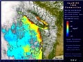 |
| SeaWiFS 1999 Composite Clouds |
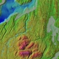 |
| BBC Topo30m Roads and Creek |
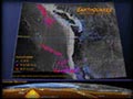 |
| Earthquakes |
|