|
|
|
|||||||
|
||||||||

|
Private GIS & Mapping Remote Sensing Columbia River Estuarine Turbidity Maxima Elliott Bay PRISM Science Retreat PRISM Seminar Series, Fall 2002 Seismology & Geodynamics Spatial Analysis Laboratory Questions or Updated: |
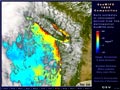
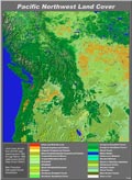
SPURS-EM PRODUCT and ANALYSIS TEAM:Strategic and Practical Use of Remotely Sensed Data in Emergency Management SPURS-EM is focusing on developmental and operational integration for the continuous use of an adaptive classified land cover product and the monthly generation of hazard specific forecasts in Emergency Management. This site support the work of the SPURS-EM product team at the University of Washington. For more information, please visit SPURS-EM PROJECT. The project is a collabrative program between . |
|
||||||||||||